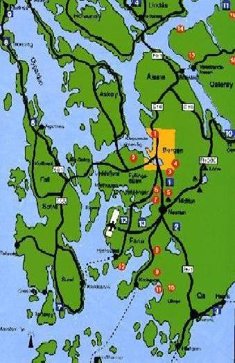
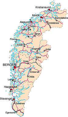
ベルゲン近郊道路地図
 4.26 morning 7 :
30, Bergen departure-E16 4.26 morning 7 :
30, Bergen departure-E16
it was fine weather though it was the raining weather yesterday. We go
out aiming at Denmark at each 1000Km straight.
Sognefjord - Oslo - Sweden - go across the sea by the ferry-Denmark.
(E16-Voss-Vinje-Stalheim-Gudvangen-R50-Flam-Aurland-R50)
|
4・26、朝7:30 ベルゲン発-E16,R585線
昨日とはうつて変わつて、雲一つない晴天の中、一路デンマ-クに向けて、1000Kmのたびに出る.
途中、ソグネフイヨルド-オスロ-スウェ-デン-フェリ-で海を渡り-デンマ-クの行程となる.
行程地図(E16-Voss-Vinje-Stalheim-Gudvangen-R50-Flam-Aurland-R50)
地図(ノルウェ-_スウェ-デン)
bergen出発-E16-
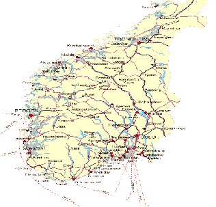
ノルウェ-道路地図 |
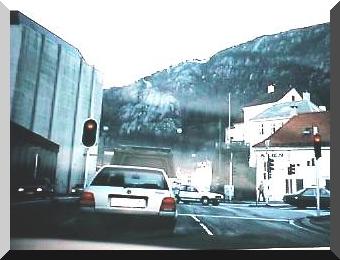
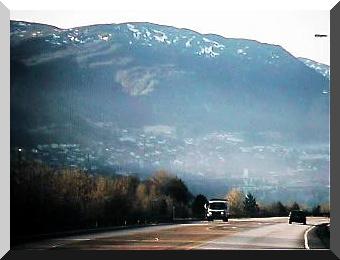
E16号線高速道路、ベルゲン郊外(4・26)
このあたりは、4車線化しており道も良く整備されていた.
ノルウェ-の高速道路の整備状況は、その地形が影響して大きな道が作りにくいようであつた.
平地が多いスウェ-デンに比べると、全体的にあまりスピ-ドを出しやすい道ではなかった.
E16
line expressway and Bergensuburbs(4・26)
As for this road, It made to four lanes and the road was maintained well.
Geographical features was steep, roads were also worse for Norway than
Sweden where a lot of plains existed,
and the car was not roads where put easily on the speed too much overall. |
E16号線高速道路、ベルゲン郊外 |
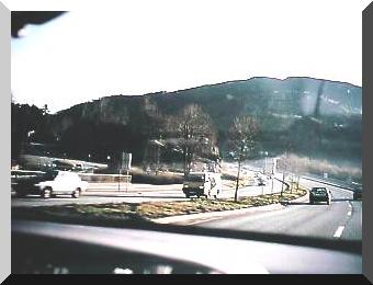
Veaフィヨルド、Inの町、E16号線高速道路 |
Veaフィヨルド、Inの町、E16号線高速道路(4・26)
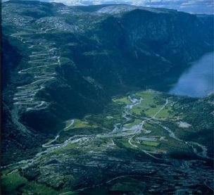
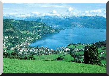
ベルゲンを出て、しばらくいくと、山のすそ野にへばりつくような町が前方に見え始めた.
フィヨルド地方典型的な風景!
We began to see the town which stuck to the skirts of a mountain in the
mountain forward when going out of Bergen and going for a while. fjord
typical scenery |
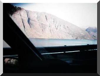
Inの町を過ぎると、Veafjordenフィヨルド沿いに、しばらくの間E16号線をVossに向けて北上する.
車の左には、フィヨルドに浸入してきた海水を満々と湛えるVeafjordenフィヨルドが続く.
前に一台観光バスが走っている,
Trengereidまでくると、R7号線へと曲がり、ハダンゲルフィヨルド観光に向かった.
The town of In passes by. The E16 line is turned to Voss at a while and
goes north along the Veafjorden fjord. The Veafjorden fjord vastly filled
with the sea water which has been infiltrated to the fjord continues to
the left of the car.
氷河時代に作られたノルウェ-を代表する4つのフィヨルドがある.図の中央部、ノルウェ-最長・最大のソグネフィヨルド、その下ベルゲンの隣のハダンゲルフィヨルド、さらにその下にリ-セフィヨルド、ソグネフィヨルドの上、北側にはガイランゲルフィヨルドがある.
 Fjord Norway Fjord Norway
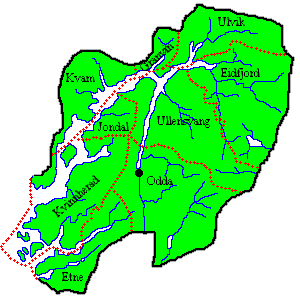
Hardanger Map
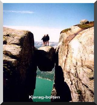
Kje蚶en
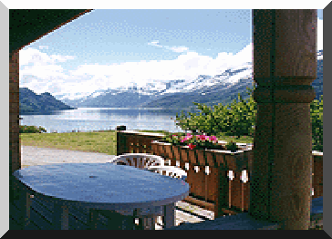
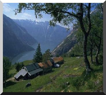
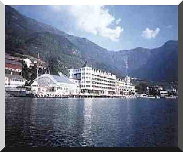
Lofthus-グリ-クがホテルから見たフィヨルドの景色-
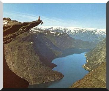
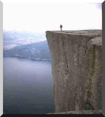
Despite the fact that the hike up to the
Pulpit takes almost 2 hours one way.At the
bottom of the Lysefjord is "Kjerag" From the top of Kjerag
there is a 1000 meters vertical drop to the
fjord..The Bolt is a rock which was stuck
between two mountain-walls when the ice retracted
many thousand years ago. 1000 meters under
you is the
Lysefjord!!
Lysefjord Map
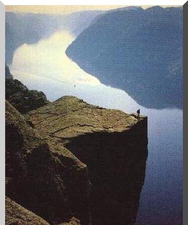
Lysefjord リ-セフィヨルド
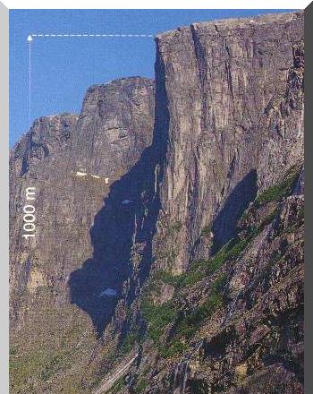
Lysefjord リ-セフィヨルド
route from Lysebotn to Sirdal. |

Veaフィヨルド、E16号線高速道路
Veaフィヨルド、E16号線高速道路
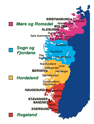
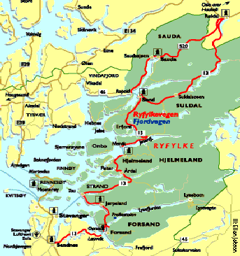
Norwayを代表する四大Fjord
ベルゲンの南にある、ノルウェ-で2番目に長いフィヨルド
R7号線で、Norheimsundヘ、さらにØystese,ハダンゲルフィヨルドに沿って、R7号線を周回、Ulvik,Eidfjord, R11号線に乗り換え、グリ-クに馴染みのLofthus,Ullensvang,さらにTyssedal,Odda、そしてRøldalヘと・・・・・・・・・
Tyssedal
Øystese
er eit generasjonshotell som ligg i den største frukthagen i Noreg,
med 450.000 frukttre, med utsikt mot Folgefonna i vest og med Hardangervidda
i ryggen i aust.
グリ-クゆかりのUllensvangホテル-ここで音楽のヒントを
ここは、プレ-ケスト-レンPulpit Rockという巨大な一枚岩で有名!ここの観光基地はStavanger、R13号線でハダンゲルフィヨルドを南下するといける.
Lysefjord リ-セフィヨルド
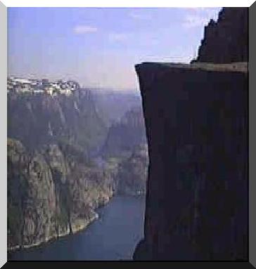
Lysefjord リ-セフィヨルド
The Bolt is a rock which was stuck between
two mountain-walls
|
