スウェ-デン内陸部 スウェ-デン内陸部
北極圏を越えたところは、白夜とオ-ロラの!!
 midnight sun白夜 - Norra Lappland- midnight sun白夜 - Norra Lappland-
Swedish inland Map
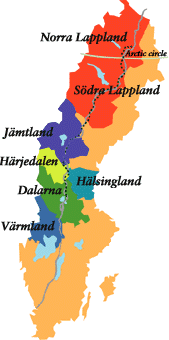
スウェ-デン内陸部-Swedish inland Destinationer
ダ-ラナ地方の地図-Dalarna
Map-
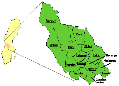
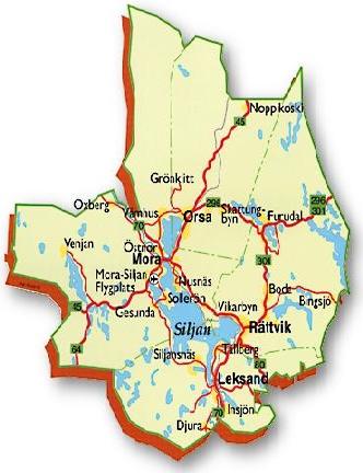
Siljan湖の周囲 Map-Dalarna-
いよいよダーラナ地方にもさよならをして、一路ノルウェーのオス向かうことになる。
出発する前にはここまでお昼ぐらいまでということで予定していたが、ストックホルムの高速道路に乗るのに意外に時間がかかってしまいダーラナ地方に到着するのは予想外に遅れた。
このためにもう時刻は6時を回っていた。
これから車を飛ばしてひたすらノルウェーのオスロを目指していくのである。
|
Swedish inland
The place where the arctic circle was exceeded is the world of the midnight
sun and the aurora
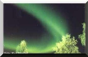 auroraオ-ロラ - Norra Lappland- auroraオ-ロラ - Norra Lappland-
R-70号線で、Siljan湖の周囲を、Leksand-Tällberg-Rättvik-Moraの順番で回る.
ム-ラを出ると、シリアン湖を迂回、R64号線を一路南下、Karlstadを目指す.
Karlstad(Map)まで、270km
 Karlstad(Värmland) Karlstad(Värmland)
Karlstad lies at the heart of Scandinavia
with Gothenburg, Stockholm, Copenhagen
and Oslo within easy reach. So it offers
the pleasures of a small town
and yet is close to the big city. The site
has been inhabited since the
early Middle Ages when it was a trading station.
Charles IX granted the
town its municipal charter in 1584 and since
then, as the county town of
Värmland, Karlstad has become a cultural
and commercial centre, an
important industrial city as well as an administrative
capital. It is well
situated both for heavy industry and for
service and computer companies;
it has excellent communications both by road,
rail and air, and the university
provides it with a well-educated workforce.
the location of Karlstad - Car-free-city -Social welfare
|
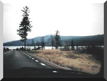
Moraム-ラを出るとstenisへ, このような森と湖の風景が続く
急に、車にも、人にも会わなくなる.
ただ、ただ、森が延!延!と続くだけ
一路、StenisからR64号線にて南下Vansbroへ
We go fromMora
south with the car <on theR64line>
straight.
Vansbro ,Malungs-map-
Mora is left and arrive atstenis.
The scenery of the forest and the lake comes into view. Rapidly, we do
not meet even the car and the person. The forest continues to both sides
of the road .long! We go from Stenis south with the car <on the R64
line> and arrives at Vansbro straight. |
MoraからR64号線にて南下Vansbroへ |
R64号線-湖-Gavunda近く
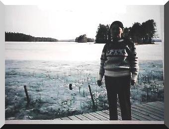
それなのにこんなに分厚い氷が湖にはっている。車を降りて湖のほとりに出ていって、この氷の上に乗ってみると、とても割れるような薄い氷ではなかった。分厚い分厚い人が乗っても割れないような氷が湖の中央まで続いていた。
冬は相当寒いのだろうなぁという感じがよく理解できた。
R64号線-湖-Gavunda近く |
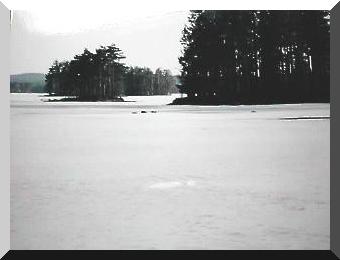
さすがにダーラナ地方の最後の都市を後にすると、車の数も人の数も極端に少なくなり、やがてほとんど何もかもがいなくなってしまった。ただひたすら森と湖が道路に続くだけである。
出てくる湖はほとんど分厚い氷に覆われている。
もう5月になろうかという時期である。
車を止めて、湖まで降りて見ると、厚い氷が湖面を覆つていた.上を歩いても割れるような厚さではなかつた.
R64 line-Gavunda
lake near-
The car is stopped, We go down to the lake,
thick ice was covered on the lake side. It is thickness which cracks even
if walking on 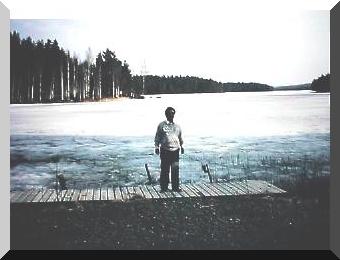
R64号線-湖-Gavunda近く
We go south with
the car <on the R64 line>.
run by car along the Van lake in theVansbro
provinces. The person and the car are not about to think that the photograph
will come here as it is seeing. An uninhabited road leads with the length・・・・・・・・ |
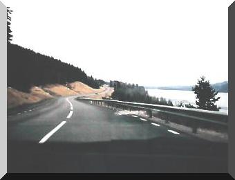
Vansbroの手前にある Van湖に沿って走る.R64号線
道はただひたすらこのような湖と森林の中を貫いて、真すぐオスロの方を向いて走っている。車に出会うこともないし、人に出会うこともないので、車の速度を走るだけ精1杯スピードを上げて飛ばしていった。もし警察官がいたらいっぺんにスピード違反でつかまるような速度であった。
次から次に森が続いている。
森の中から、木材集積場が現れる.
木材の成長が遅いせいか、材木が細いのが印象的であつた.
木材、パルプの国らしく、木材集積場ガ途中でよく見られた.
R64号線 木材集積場 |
R64号線にて南下Vansbroの手前にある
Van湖に沿って走る.
ご覧のように、ここまで来ると人も車も見かけない.
タダ!タダ!無人の道路が・・・・・・・・
Vansbroの手前にある Van湖に沿って走る.R64号線
Wood accumulation
scene on the R64
line
In the forest, there was a wood accumulation scene.
It is impressive !!
The growth of wood is slow because of a cold climate.
The diameter of the cut of the wood is also
small. There are a lot of thin
trees. This country is a country of the forest.
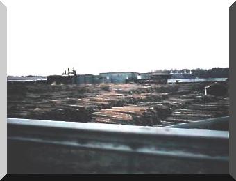
R64号線 木材集積場 |